surveyed
building
500+
surveyed
m²
2 000 000+
instrument position
139 000+
GB instrument
data file
44 000+
About us
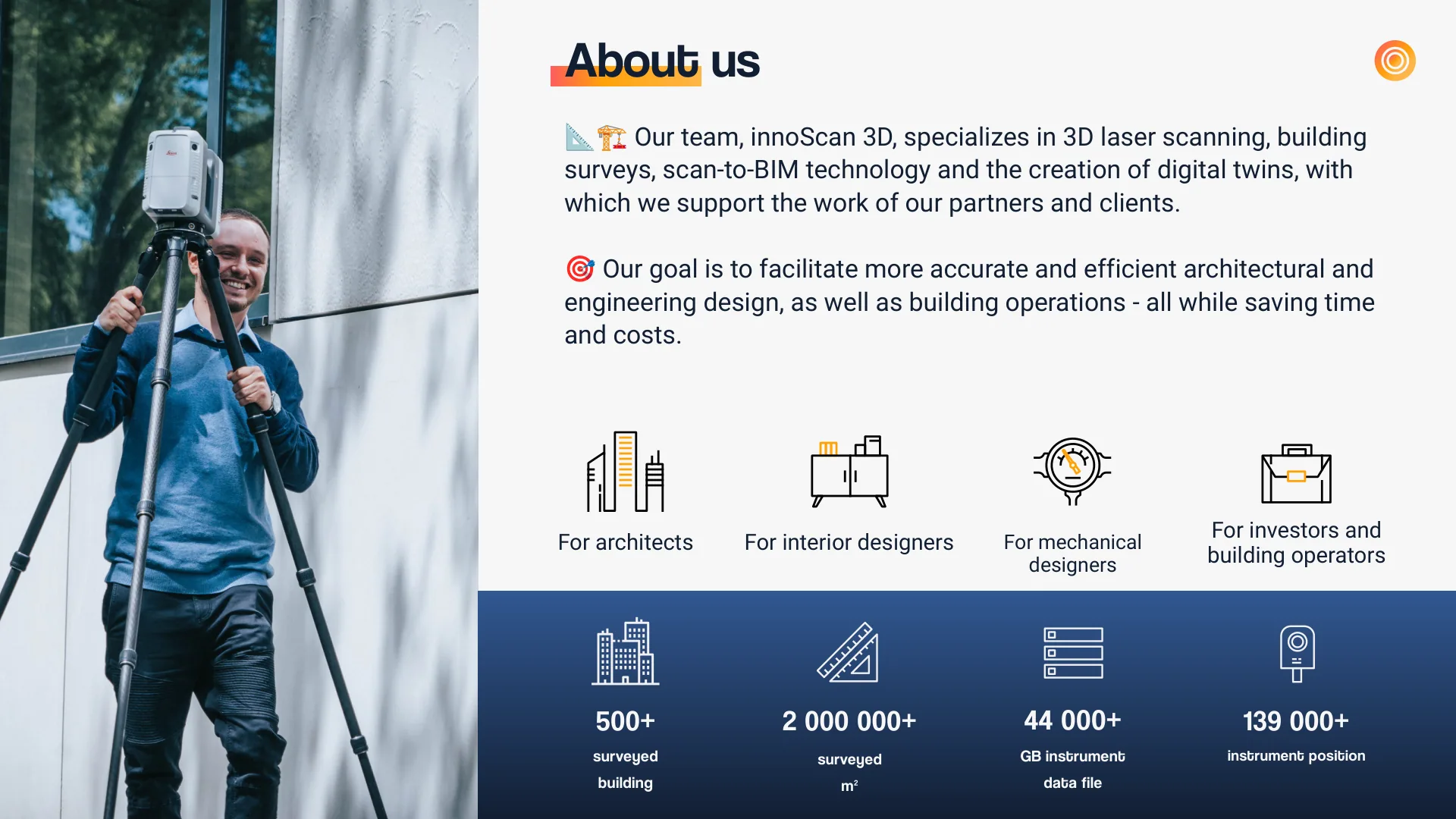
📐🏗️ Our team, innoScan 3D, specializes in 3D laser scanning, building
surveys, scan-to-BIM technology and the creation of digital twins, with
which we support the work of our partners and clients.
🎯 Our goal is to facilitate more accurate and efficient architectural and
engineering design, as well as building operations - all while saving time
and costs.
For architects
For mechanical
designers
For interior designers
For investors and
building operators
building
500+
surveyed
m²
2 000 000+
instrument position
139 000+
GB instrument
data file
44 000+
About us
📐🏗️ Our team, innoScan 3D, specializes in 3D laser scanning, building
surveys, scan-to-BIM technology and the creation of digital twins, with
which we support the work of our partners and clients.
🎯 Our goal is to facilitate more accurate and efficient architectural and
engineering design, as well as building operations - all while saving time
and costs.
For architects
For mechanical
designers
For interior designers
For investors and
building operators
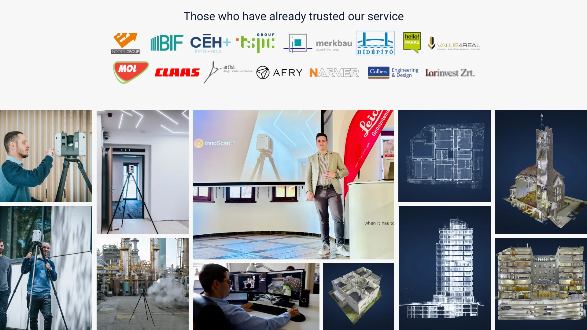
Those who have already trusted our service
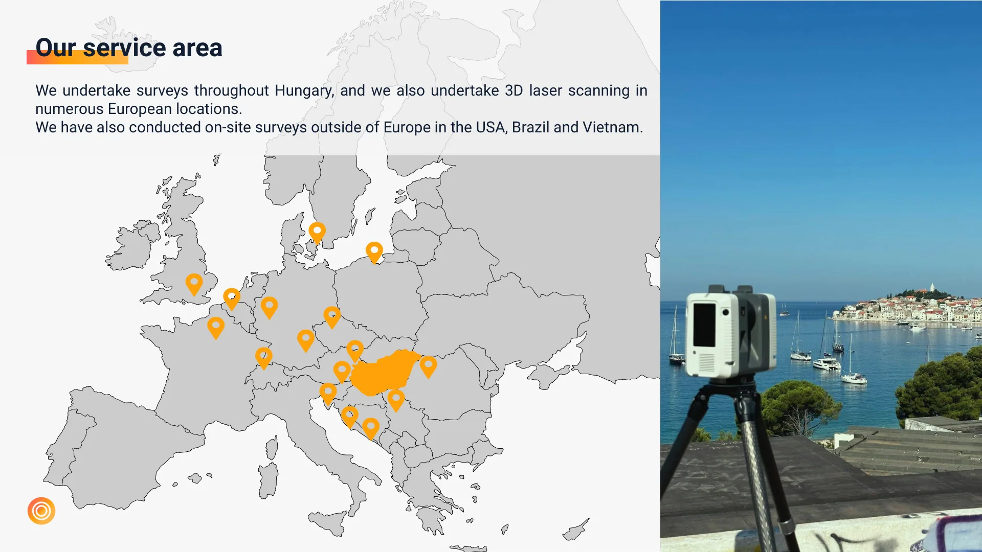
Our service area
We undertake surveys throughout Hungary, and we also undertake 3D laser scanning in
numerous European locations.
We have also conducted on-site surveys outside of Europe in the USA, Brazil and Vietnam.
We undertake surveys throughout Hungary, and we also undertake 3D laser scanning in
numerous European locations.
We have also conducted on-site surveys outside of Europe in the USA, Brazil and Vietnam.
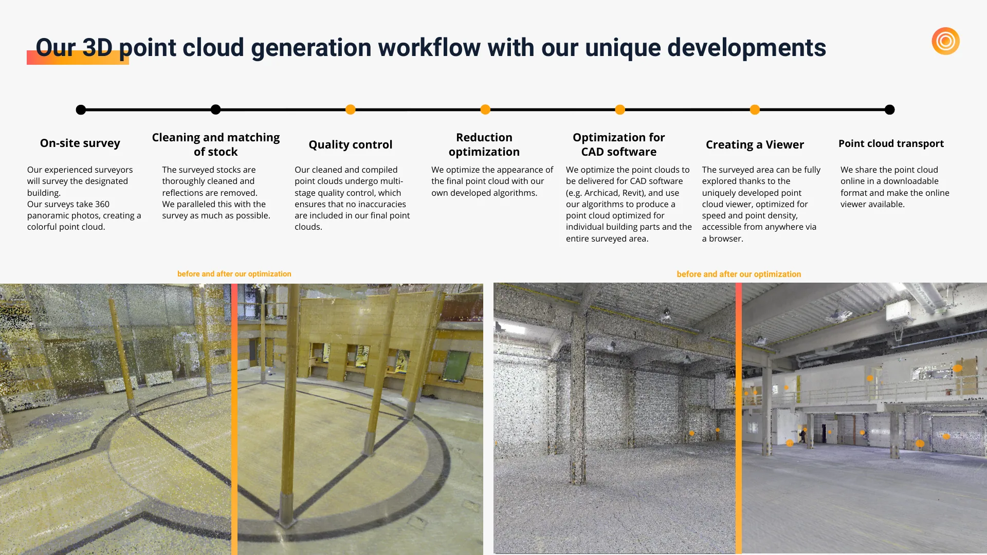
Our 3D point cloud generation workflow with our unique developments
before and after our optimization
before and after our optimization
Point cloud transport
We share the point cloud
online in a downloadable
format and make the online
viewer available.
On-site survey
Our experienced surveyors
will survey the designated
building.
Our surveys take 360
panoramic photos, creating a
colorful point cloud.
Cleaning and matching
of stock
The surveyed stocks are
thoroughly cleaned and
reflections are removed.
We paralleled this with the
survey as much as possible.
Quality control
Our cleaned and compiled
point clouds undergo multi-
stage quality control, which
ensures that no inaccuracies
are included in our final point
clouds.
Reduction
optimization
We optimize the appearance of
the final point cloud with our
own developed algorithms.
Optimization for
CAD software
We optimize the point clouds to
be delivered for CAD software
(e.g. Archicad, Revit), and use
our algorithms to produce a
point cloud optimized for
individual building parts and the
entire surveyed area.
Creating a Viewer
The surveyed area can be fully
explored thanks to the
uniquely developed point
cloud viewer, optimized for
speed and point density,
accessible from anywhere via
a browser.
before and after our optimization
before and after our optimization
Point cloud transport
We share the point cloud
online in a downloadable
format and make the online
viewer available.
On-site survey
Our experienced surveyors
will survey the designated
building.
Our surveys take 360
panoramic photos, creating a
colorful point cloud.
Cleaning and matching
of stock
The surveyed stocks are
thoroughly cleaned and
reflections are removed.
We paralleled this with the
survey as much as possible.
Quality control
Our cleaned and compiled
point clouds undergo multi-
stage quality control, which
ensures that no inaccuracies
are included in our final point
clouds.
Reduction
optimization
We optimize the appearance of
the final point cloud with our
own developed algorithms.
Optimization for
CAD software
We optimize the point clouds to
be delivered for CAD software
(e.g. Archicad, Revit), and use
our algorithms to produce a
point cloud optimized for
individual building parts and the
entire surveyed area.
Creating a Viewer
The surveyed area can be fully
explored thanks to the
uniquely developed point
cloud viewer, optimized for
speed and point density,
accessible from anywhere via
a browser.
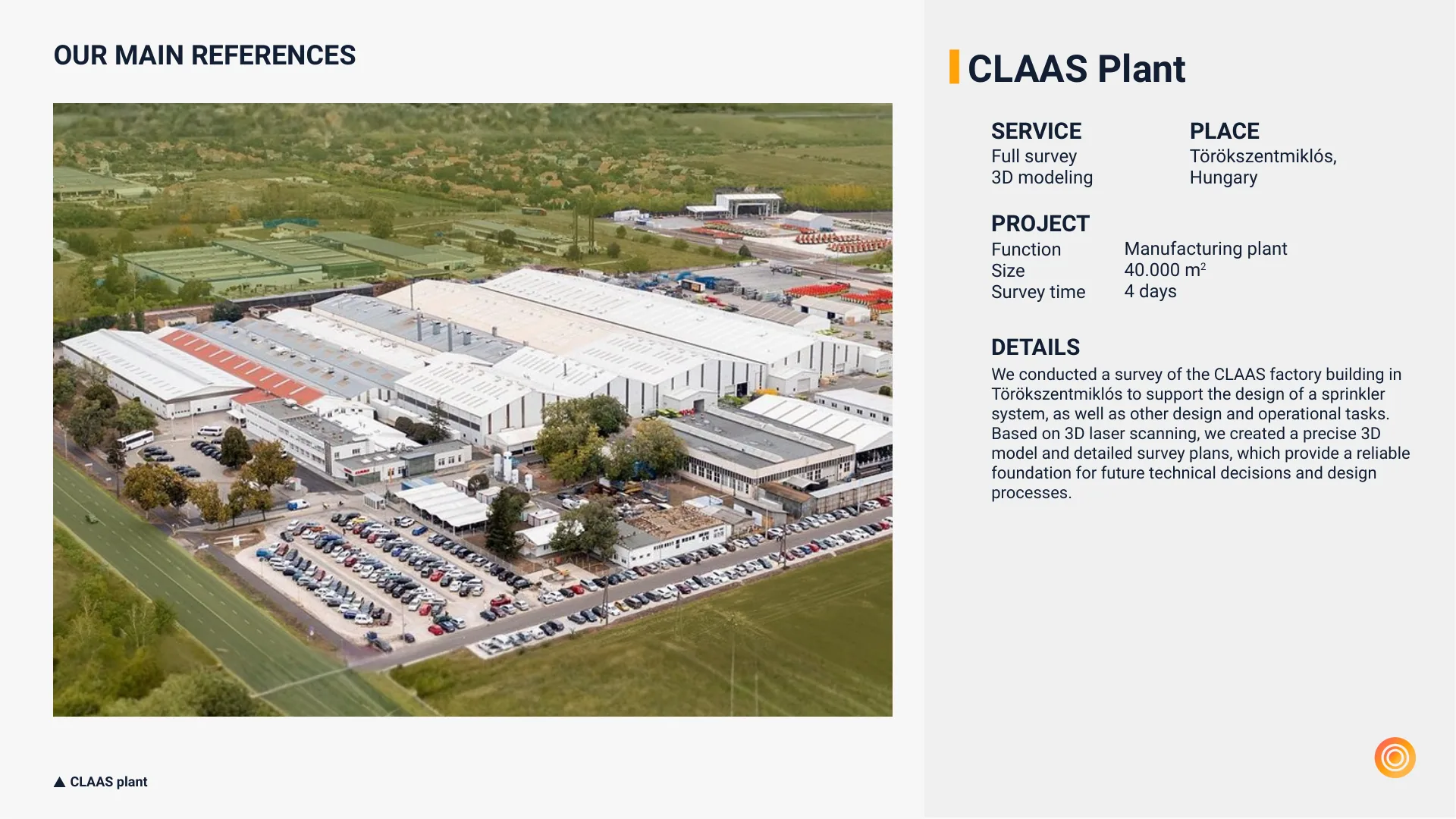
CLAAS plant
CLAAS Plant
SERVICE
PLACE
Full survey
3D modeling
Törökszentmiklós,
Hungary
PROJECT
Manufacturing plant
40.000 m
4 days
2
DETAILS
We conducted a survey of the CLAAS factory building in
Törökszentmiklós to support the design of a sprinkler
system, as well as other design and operational tasks.
Based on 3D laser scanning, we created a precise 3D
model and detailed survey plans, which provide a reliable
foundation for future technical decisions and design
processes.
OUR MAIN REFERENCES
Function
Size
Survey time
CLAAS Plant
SERVICE
PLACE
Full survey
3D modeling
Törökszentmiklós,
Hungary
PROJECT
Manufacturing plant
40.000 m
4 days
2
DETAILS
We conducted a survey of the CLAAS factory building in
Törökszentmiklós to support the design of a sprinkler
system, as well as other design and operational tasks.
Based on 3D laser scanning, we created a precise 3D
model and detailed survey plans, which provide a reliable
foundation for future technical decisions and design
processes.
OUR MAIN REFERENCES
Function
Size
Survey time
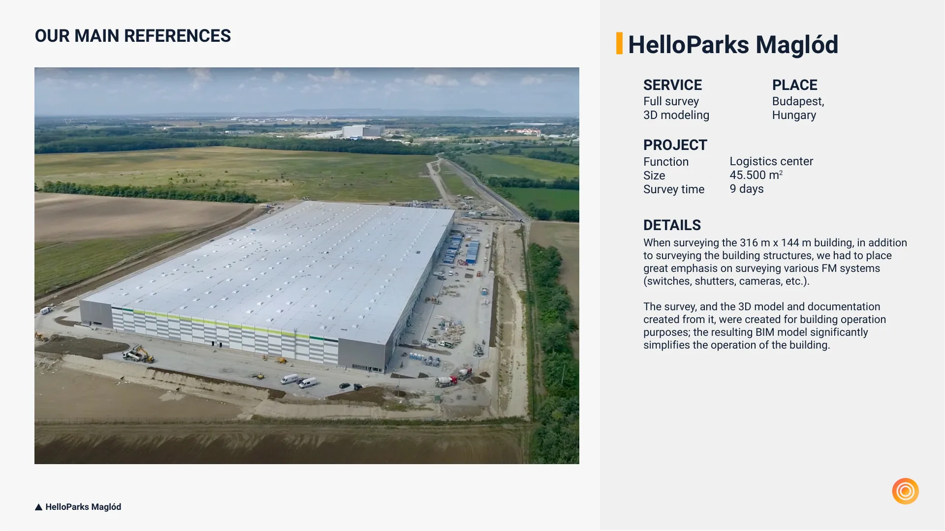
HelloParks Maglód
HelloParks Maglód
SERVICE
PLACE
Full survey
3D modeling
Budapest,
Hungary
PROJECT
Logistics center
45.500 m
9 days
2
DETAILS
When surveying the 316 m x 144 m building, in addition
to surveying the building structures, we had to place
great emphasis on surveying various FM systems
(switches, shutters, cameras, etc.).
The survey, and the 3D model and documentation
created from it, were created for building operation
purposes; the resulting BIM model significantly
simplifies the operation of the building.
OUR MAIN REFERENCES
Function
Size
Survey time
HelloParks Maglód
SERVICE
PLACE
Full survey
3D modeling
Budapest,
Hungary
PROJECT
Logistics center
45.500 m
9 days
2
DETAILS
When surveying the 316 m x 144 m building, in addition
to surveying the building structures, we had to place
great emphasis on surveying various FM systems
(switches, shutters, cameras, etc.).
The survey, and the 3D model and documentation
created from it, were created for building operation
purposes; the resulting BIM model significantly
simplifies the operation of the building.
OUR MAIN REFERENCES
Function
Size
Survey time
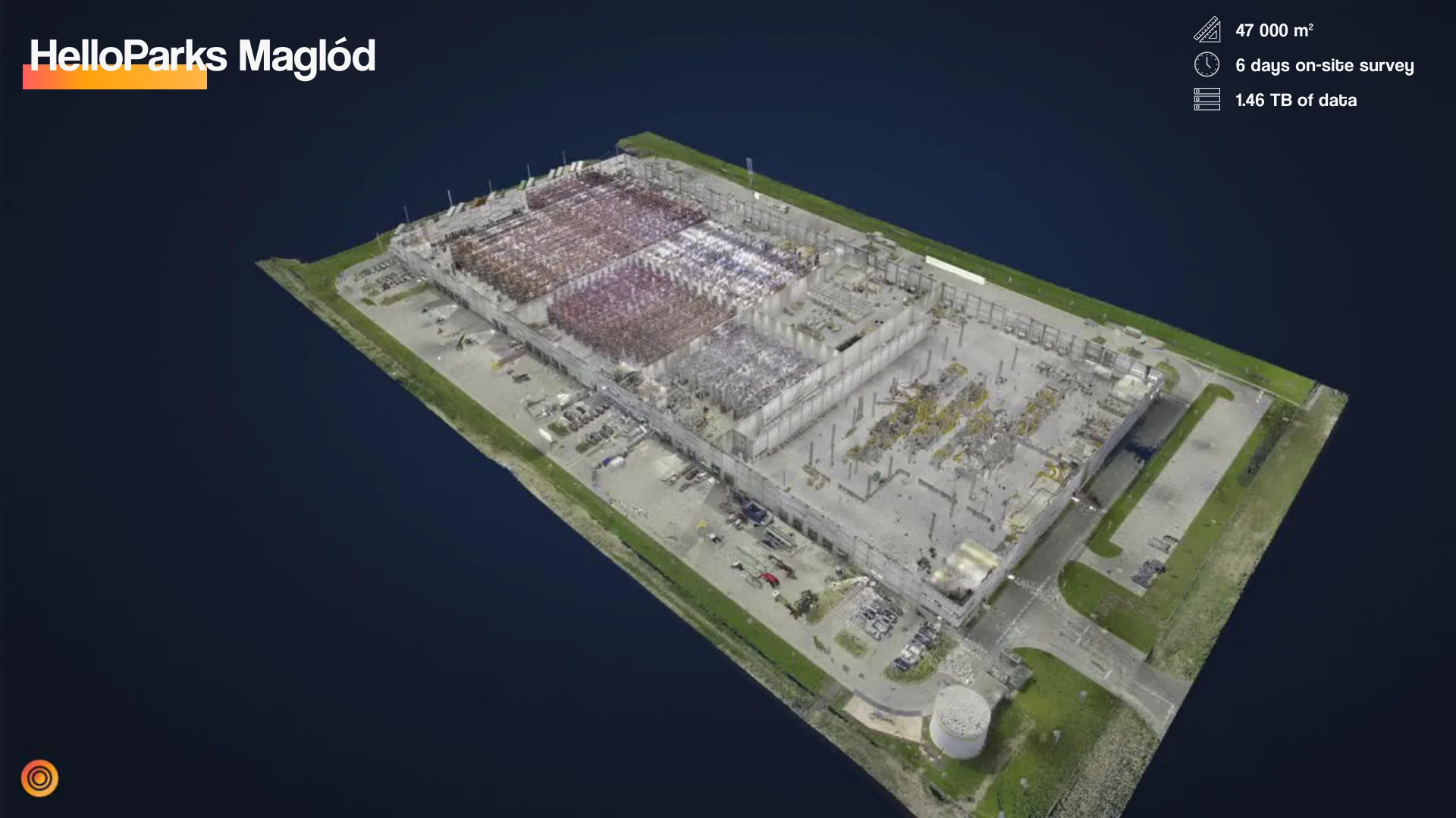
47 000 m²
1.46 TB of data
6 days on-site survey
HelloParks Maglód
1.46 TB of data
6 days on-site survey
HelloParks Maglód
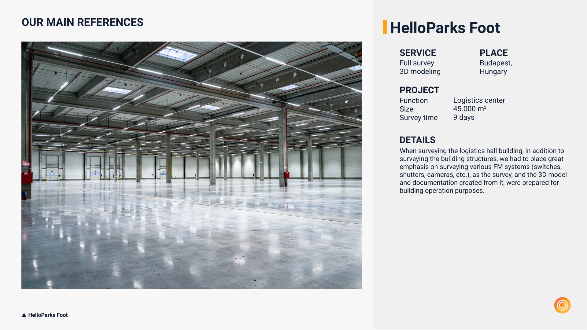
HelloParks Foot
HelloParks Foot
SERVICE
PLACE
Full survey
3D modeling
Budapest,
Hungary
PROJECT
Logistics center
45.000 m
9 days
2
DETAILS
When surveying the logistics hall building, in addition to
surveying the building structures, we had to place great
emphasis on surveying various FM systems (switches,
shutters, cameras, etc.), as the survey, and the 3D model
and documentation created from it, were prepared for
building operation purposes.
OUR MAIN REFERENCES
Function
Size
Survey time
HelloParks Foot
SERVICE
PLACE
Full survey
3D modeling
Budapest,
Hungary
PROJECT
Logistics center
45.000 m
9 days
2
DETAILS
When surveying the logistics hall building, in addition to
surveying the building structures, we had to place great
emphasis on surveying various FM systems (switches,
shutters, cameras, etc.), as the survey, and the 3D model
and documentation created from it, were prepared for
building operation purposes.
OUR MAIN REFERENCES
Function
Size
Survey time
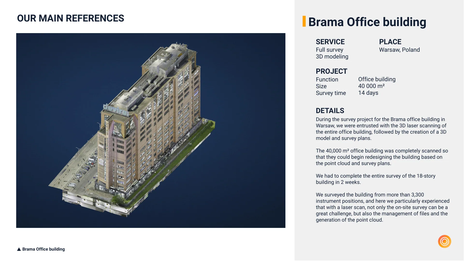
Brama Office building
Full survey
3D modeling
Warsaw, Poland
Function
Size
Survey time
Office building
40 000 m²
14 days
During the survey project for the Brama office building in
Warsaw, we were entrusted with the 3D laser scanning of
the entire office building, followed by the creation of a 3D
model and survey plans.
The 40,000 m² office building was completely scanned so
that they could begin redesigning the building based on
the point cloud and survey plans.
We had to complete the entire survey of the 18-story
building in 2 weeks.
We surveyed the building from more than 3,300
instrument positions, and here we particularly experienced
that with a laser scan, not only the on-site survey can be a
great challenge, but also the management of files and the
generation of the point cloud.
OUR MAIN REFERENCES
Brama Office building
SERVICE
PLACE
PROJECT
DETAILS
Full survey
3D modeling
Warsaw, Poland
Function
Size
Survey time
Office building
40 000 m²
14 days
During the survey project for the Brama office building in
Warsaw, we were entrusted with the 3D laser scanning of
the entire office building, followed by the creation of a 3D
model and survey plans.
The 40,000 m² office building was completely scanned so
that they could begin redesigning the building based on
the point cloud and survey plans.
We had to complete the entire survey of the 18-story
building in 2 weeks.
We surveyed the building from more than 3,300
instrument positions, and here we particularly experienced
that with a laser scan, not only the on-site survey can be a
great challenge, but also the management of files and the
generation of the point cloud.
OUR MAIN REFERENCES
Brama Office building
SERVICE
PLACE
PROJECT
DETAILS
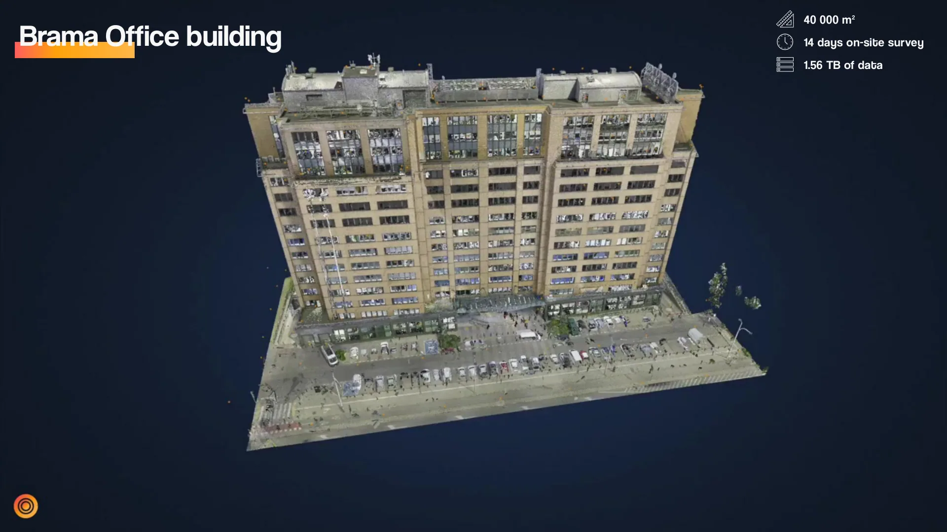
40 000 m²
1.56 TB of data
14 days on-site survey
Brama Office building
1.56 TB of data
14 days on-site survey
Brama Office building
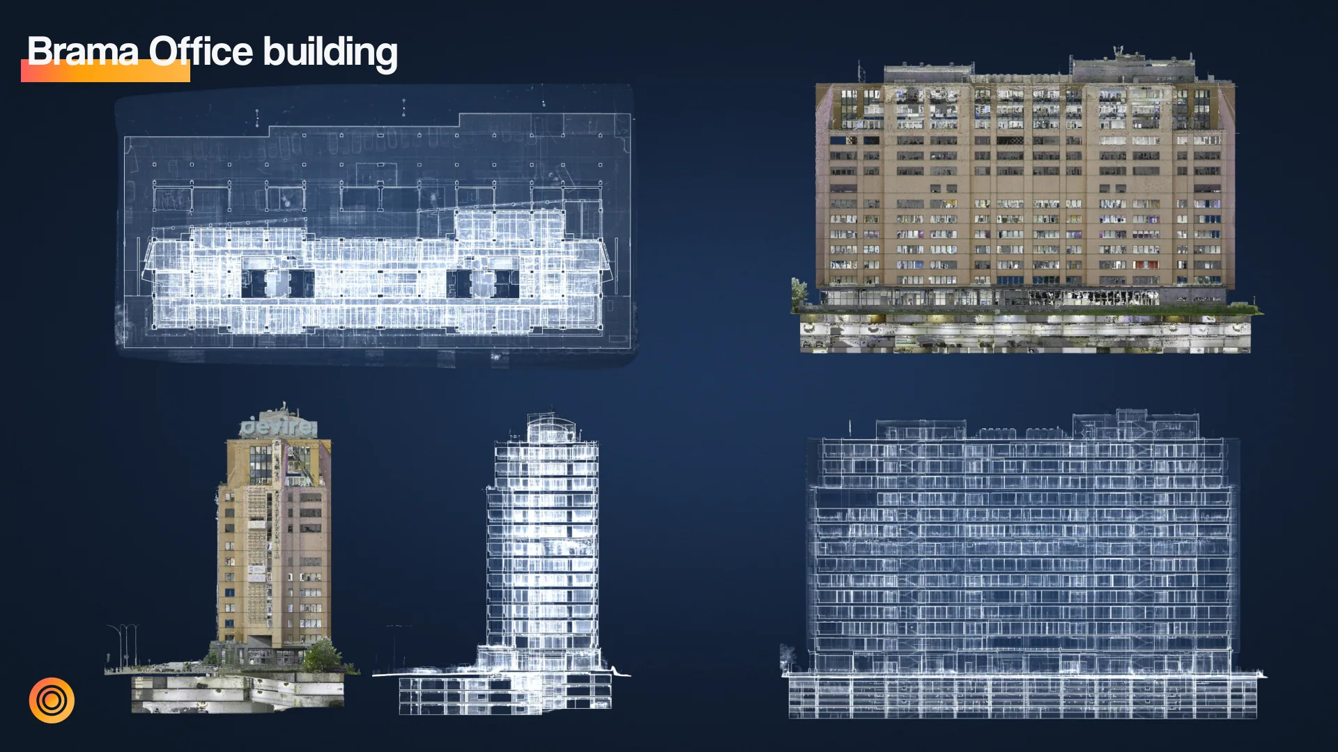
Brama Office building
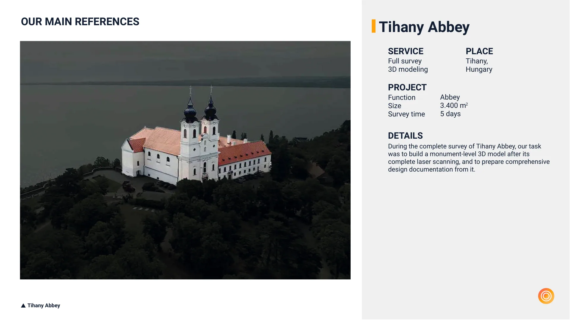
Tihany Abbey
SERVICE
PLACE
Full survey
3D modeling
Tihany,
Hungary
PROJECT
Abbey
3.400 m
5 days
2
DETAILS
During the complete survey of Tihany Abbey, our task
was to build a monument-level 3D model after its
complete laser scanning, and to prepare comprehensive
design documentation from it.
OUR MAIN REFERENCES
Tihany Abbey
Function
Size
Survey time
SERVICE
PLACE
Full survey
3D modeling
Tihany,
Hungary
PROJECT
Abbey
3.400 m
5 days
2
DETAILS
During the complete survey of Tihany Abbey, our task
was to build a monument-level 3D model after its
complete laser scanning, and to prepare comprehensive
design documentation from it.
OUR MAIN REFERENCES
Tihany Abbey
Function
Size
Survey time
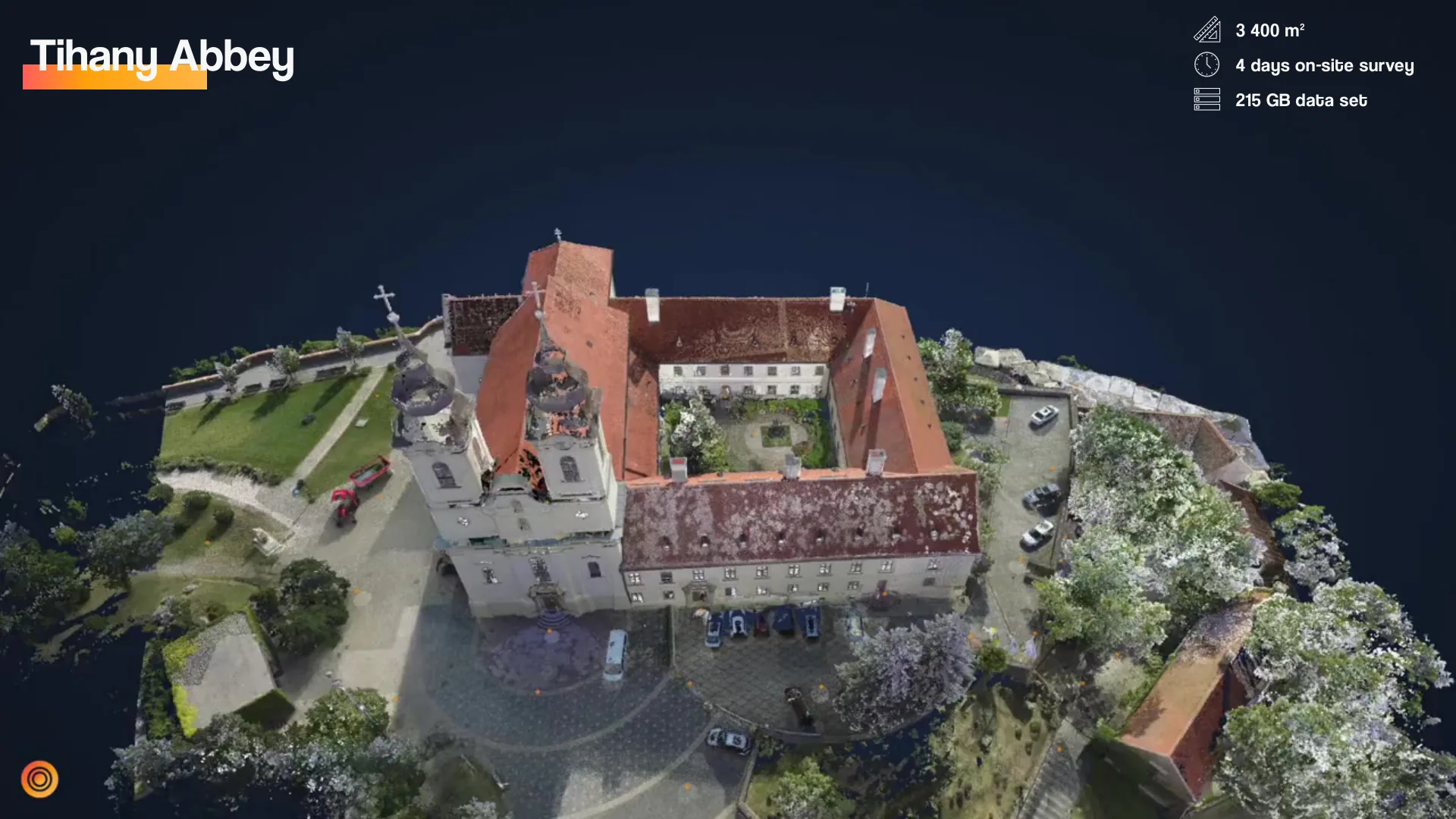
3 400 m²
215 GB data set
4 days on-site survey
Tihany Abbey
215 GB data set
4 days on-site survey
Tihany Abbey
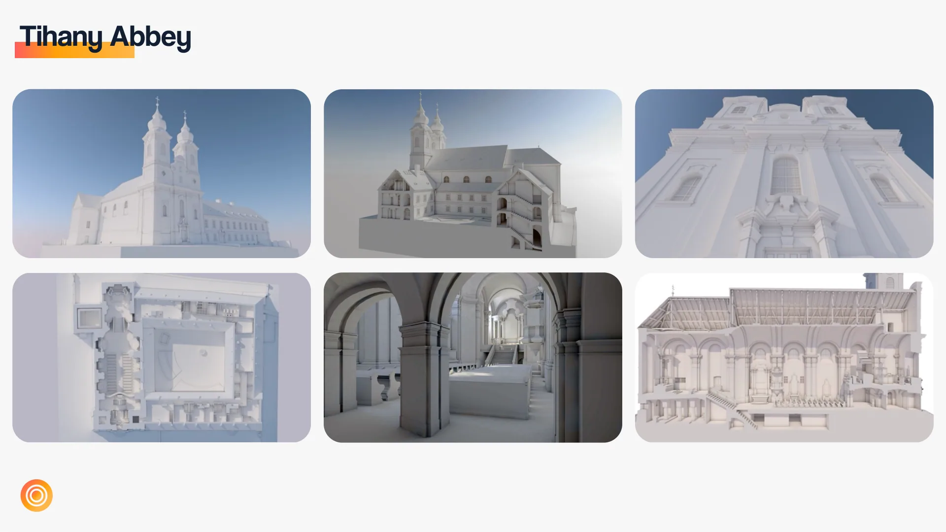
Tihany Abbey
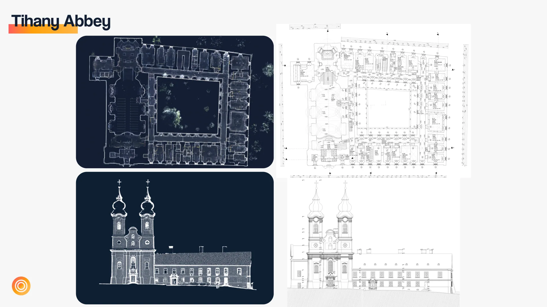
Tihany Abbey
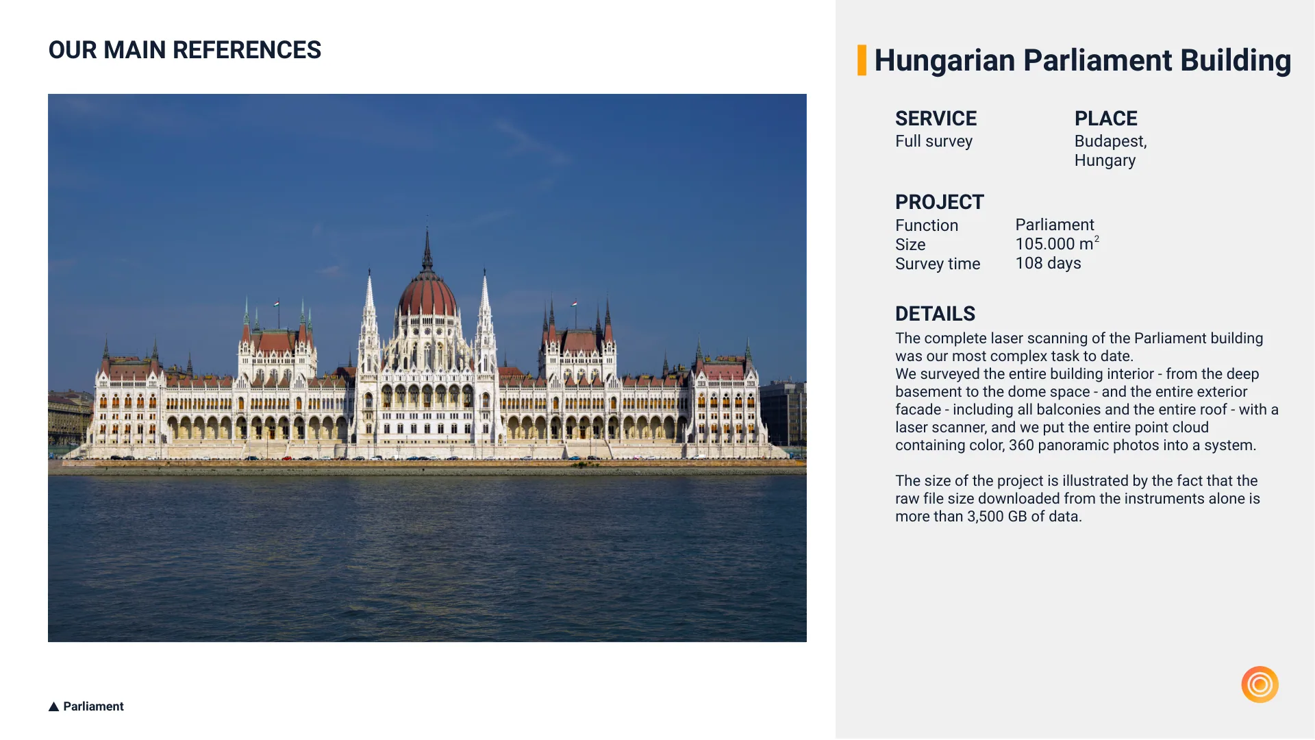
Parliament
Hungarian Parliament Building
SERVICE
PLACE
Full survey
Budapest,
Hungary
PROJECT
Function
Size
Survey time
Parliament
105.000 m
108 days
2
DETAILS
The complete laser scanning of the Parliament building
was our most complex task to date.
We surveyed the entire building interior - from the deep
basement to the dome space - and the entire exterior
facade - including all balconies and the entire roof - with a
laser scanner, and we put the entire point cloud
containing color, 360 panoramic photos into a system.
The size of the project is illustrated by the fact that the
raw file size downloaded from the instruments alone is
more than 3,500 GB of data.
OUR MAIN REFERENCES
Hungarian Parliament Building
SERVICE
PLACE
Full survey
Budapest,
Hungary
PROJECT
Function
Size
Survey time
Parliament
105.000 m
108 days
2
DETAILS
The complete laser scanning of the Parliament building
was our most complex task to date.
We surveyed the entire building interior - from the deep
basement to the dome space - and the entire exterior
facade - including all balconies and the entire roof - with a
laser scanner, and we put the entire point cloud
containing color, 360 panoramic photos into a system.
The size of the project is illustrated by the fact that the
raw file size downloaded from the instruments alone is
more than 3,500 GB of data.
OUR MAIN REFERENCES
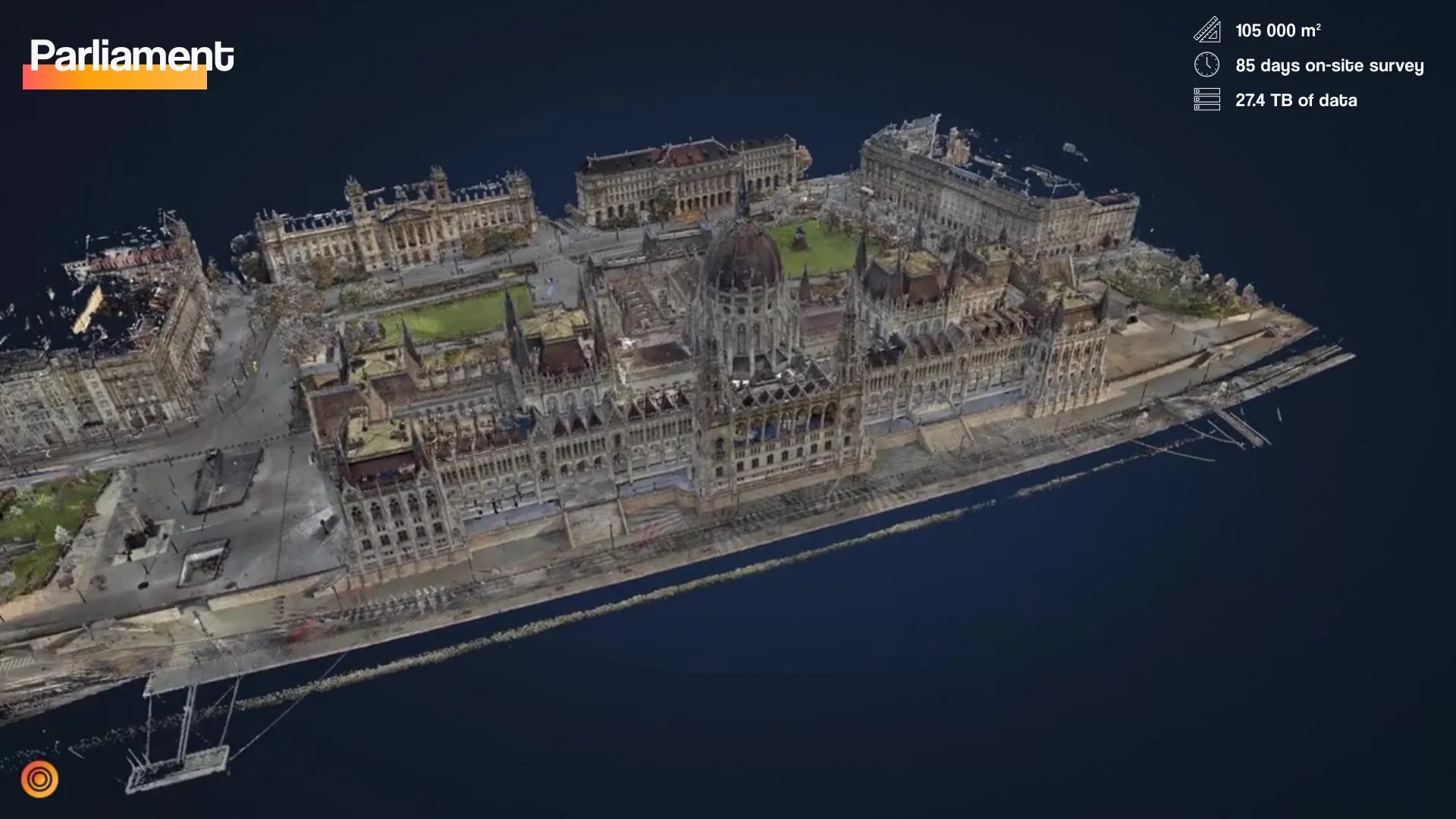
105 000 m²
27.4 TB of data
85 days on-site survey
Parliament
27.4 TB of data
85 days on-site survey
Parliament
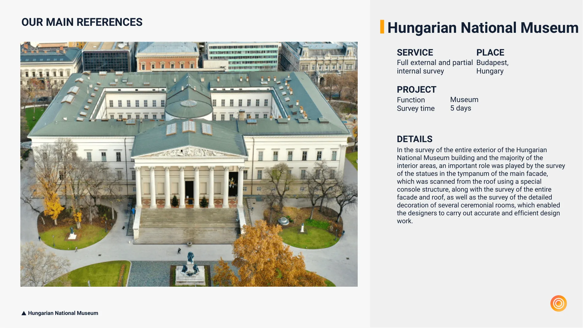
Hungarian National Museum
SERVICE
PLACE
Full external and partial
internal survey
Budapest,
Hungary
PROJECT
Function
Survey time
Museum
5 days
DETAILS
In the survey of the entire exterior of the Hungarian
National Museum building and the majority of the
interior areas, an important role was played by the survey
of the statues in the tympanum of the main facade,
which was scanned from the roof using a special
console structure, along with the survey of the entire
facade and roof, as well as the survey of the detailed
decoration of several ceremonial rooms, which enabled
the designers to carry out accurate and efficient design
work.
OUR MAIN REFERENCES
Hungarian National Museum
SERVICE
PLACE
Full external and partial
internal survey
Budapest,
Hungary
PROJECT
Function
Survey time
Museum
5 days
DETAILS
In the survey of the entire exterior of the Hungarian
National Museum building and the majority of the
interior areas, an important role was played by the survey
of the statues in the tympanum of the main facade,
which was scanned from the roof using a special
console structure, along with the survey of the entire
facade and roof, as well as the survey of the detailed
decoration of several ceremonial rooms, which enabled
the designers to carry out accurate and efficient design
work.
OUR MAIN REFERENCES
Hungarian National Museum
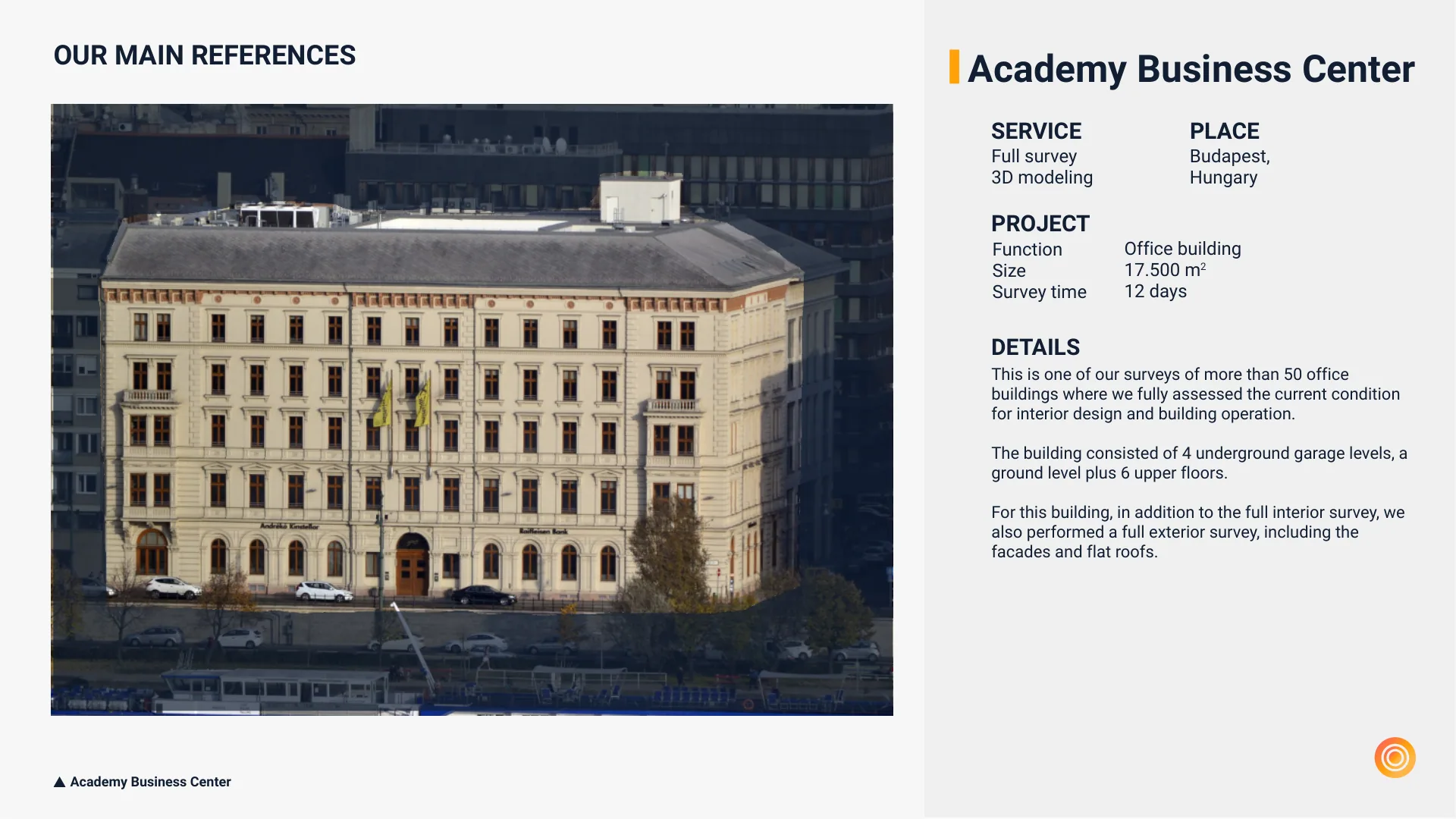
Academy Business Center
SERVICE
PLACE
Full survey
3D modeling
Budapest,
Hungary
PROJECT
Office building
17.500 m
12 days
2
DETAILS
This is one of our surveys of more than 50 office
buildings where we fully assessed the current condition
for interior design and building operation.
The building consisted of 4 underground garage levels, a
ground level plus 6 upper floors.
For this building, in addition to the full interior survey, we
also performed a full exterior survey, including the
facades and flat roofs.
OUR MAIN REFERENCES
Academy Business Center
Function
Size
Survey time
SERVICE
PLACE
Full survey
3D modeling
Budapest,
Hungary
PROJECT
Office building
17.500 m
12 days
2
DETAILS
This is one of our surveys of more than 50 office
buildings where we fully assessed the current condition
for interior design and building operation.
The building consisted of 4 underground garage levels, a
ground level plus 6 upper floors.
For this building, in addition to the full interior survey, we
also performed a full exterior survey, including the
facades and flat roofs.
OUR MAIN REFERENCES
Academy Business Center
Function
Size
Survey time
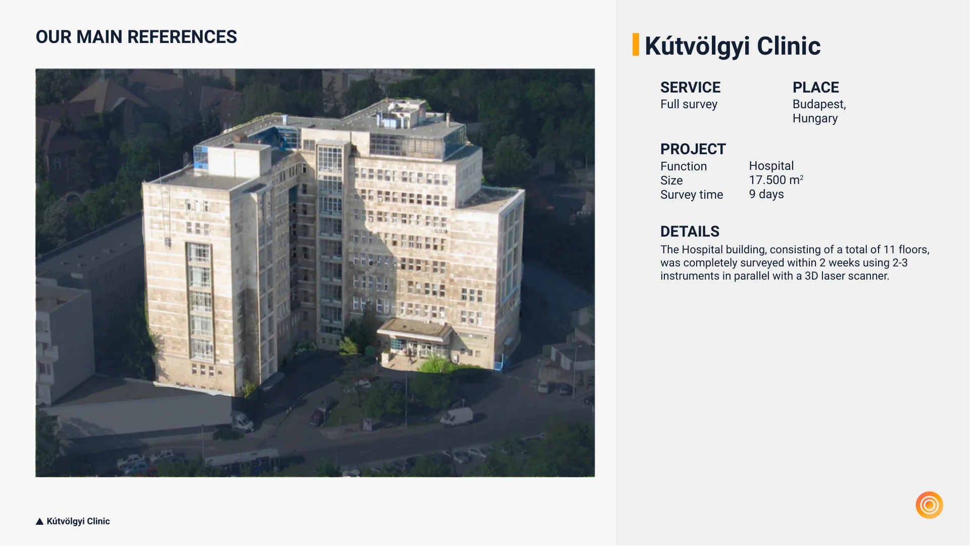
Kútvölgyi Clinic
Kútvölgyi Clinic
SERVICE
PLACE
Full survey
Budapest,
Hungary
PROJECT
Hospital
17.500 m
9 days
2
DETAILS
The Hospital building, consisting of a total of 11 floors,
was completely surveyed within 2 weeks using 2-3
instruments in parallel with a 3D laser scanner.
OUR MAIN REFERENCES
Function
Size
Survey time
Kútvölgyi Clinic
SERVICE
PLACE
Full survey
Budapest,
Hungary
PROJECT
Hospital
17.500 m
9 days
2
DETAILS
The Hospital building, consisting of a total of 11 floors,
was completely surveyed within 2 weeks using 2-3
instruments in parallel with a 3D laser scanner.
OUR MAIN REFERENCES
Function
Size
Survey time
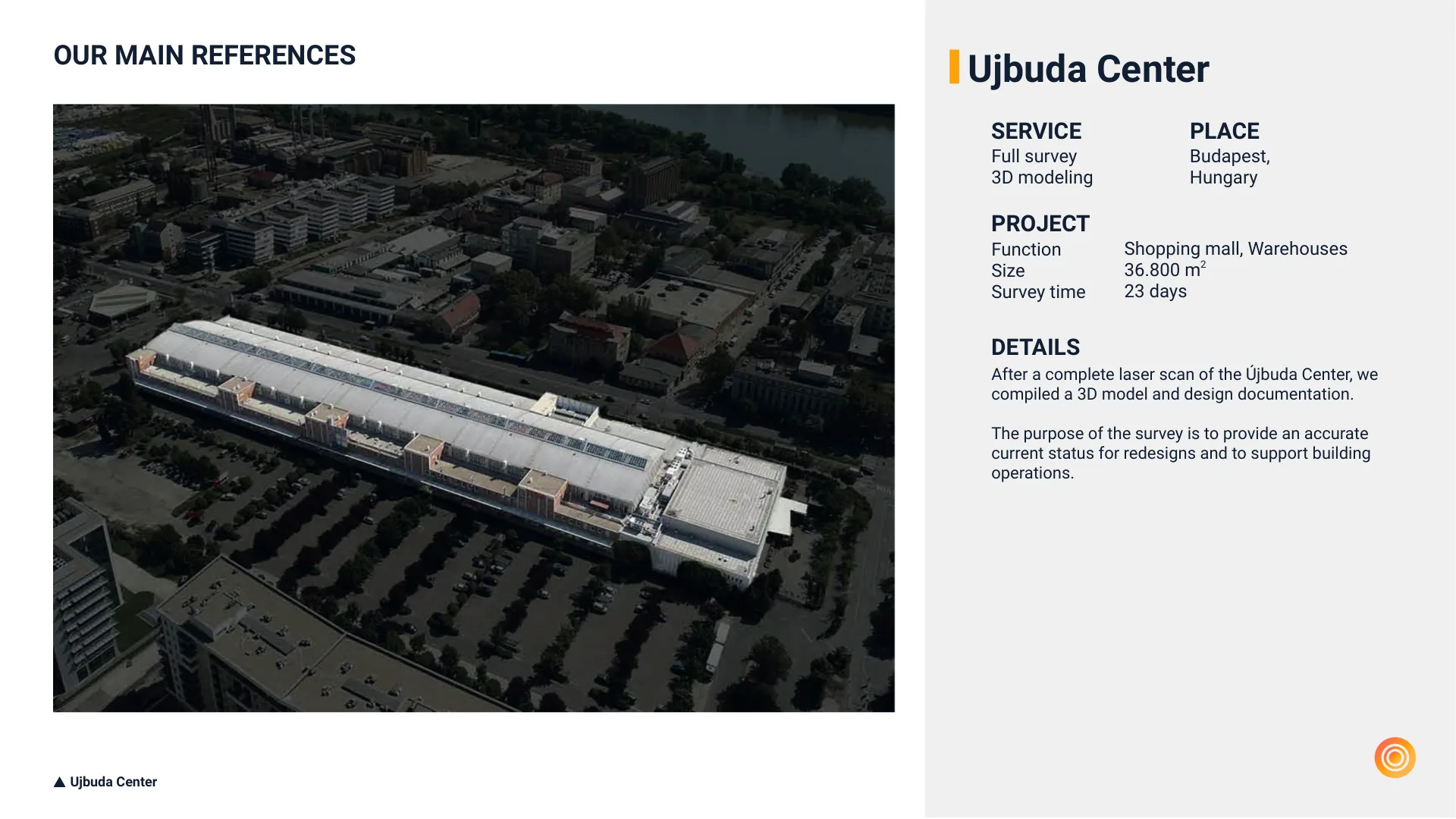
Ujbuda Center
SERVICE
PLACE
Full survey
3D modeling
Budapest,
Hungary
PROJECT
Shopping mall, Warehouses
36.800 m
23 days
2
DETAILS
After a complete laser scan of the Újbuda Center, we
compiled a 3D model and design documentation.
The purpose of the survey is to provide an accurate
current status for redesigns and to support building
operations.
OUR MAIN REFERENCES
Ujbuda Center
Function
Size
Survey time
SERVICE
PLACE
Full survey
3D modeling
Budapest,
Hungary
PROJECT
Shopping mall, Warehouses
36.800 m
23 days
2
DETAILS
After a complete laser scan of the Újbuda Center, we
compiled a 3D model and design documentation.
The purpose of the survey is to provide an accurate
current status for redesigns and to support building
operations.
OUR MAIN REFERENCES
Ujbuda Center
Function
Size
Survey time
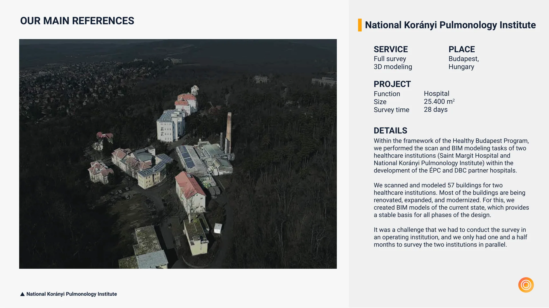
National Korányi Pulmonology Institute
SERVICE
PLACE
Full survey
3D modeling
Budapest,
Hungary
PROJECT
Hospital
25.400 m
28 days
2
DETAILS
Within the framework of the Healthy Budapest Program,
we performed the scan and BIM modeling tasks of two
healthcare institutions (Saint Margit Hospital and
National Korányi Pulmonology Institute) within the
development of the ÉPC and DBC partner hospitals.
We scanned and modeled 57 buildings for two
healthcare institutions. Most of the buildings are being
renovated, expanded, and modernized. For this, we
created BIM models of the current state, which provides
a stable basis for all phases of the design.
It was a challenge that we had to conduct the survey in
an operating institution, and we only had one and a half
months to survey the two institutions in parallel.
OUR MAIN REFERENCES
National Korányi Pulmonology Institute
Function
Size
Survey time
SERVICE
PLACE
Full survey
3D modeling
Budapest,
Hungary
PROJECT
Hospital
25.400 m
28 days
2
DETAILS
Within the framework of the Healthy Budapest Program,
we performed the scan and BIM modeling tasks of two
healthcare institutions (Saint Margit Hospital and
National Korányi Pulmonology Institute) within the
development of the ÉPC and DBC partner hospitals.
We scanned and modeled 57 buildings for two
healthcare institutions. Most of the buildings are being
renovated, expanded, and modernized. For this, we
created BIM models of the current state, which provides
a stable basis for all phases of the design.
It was a challenge that we had to conduct the survey in
an operating institution, and we only had one and a half
months to survey the two institutions in parallel.
OUR MAIN REFERENCES
National Korányi Pulmonology Institute
Function
Size
Survey time
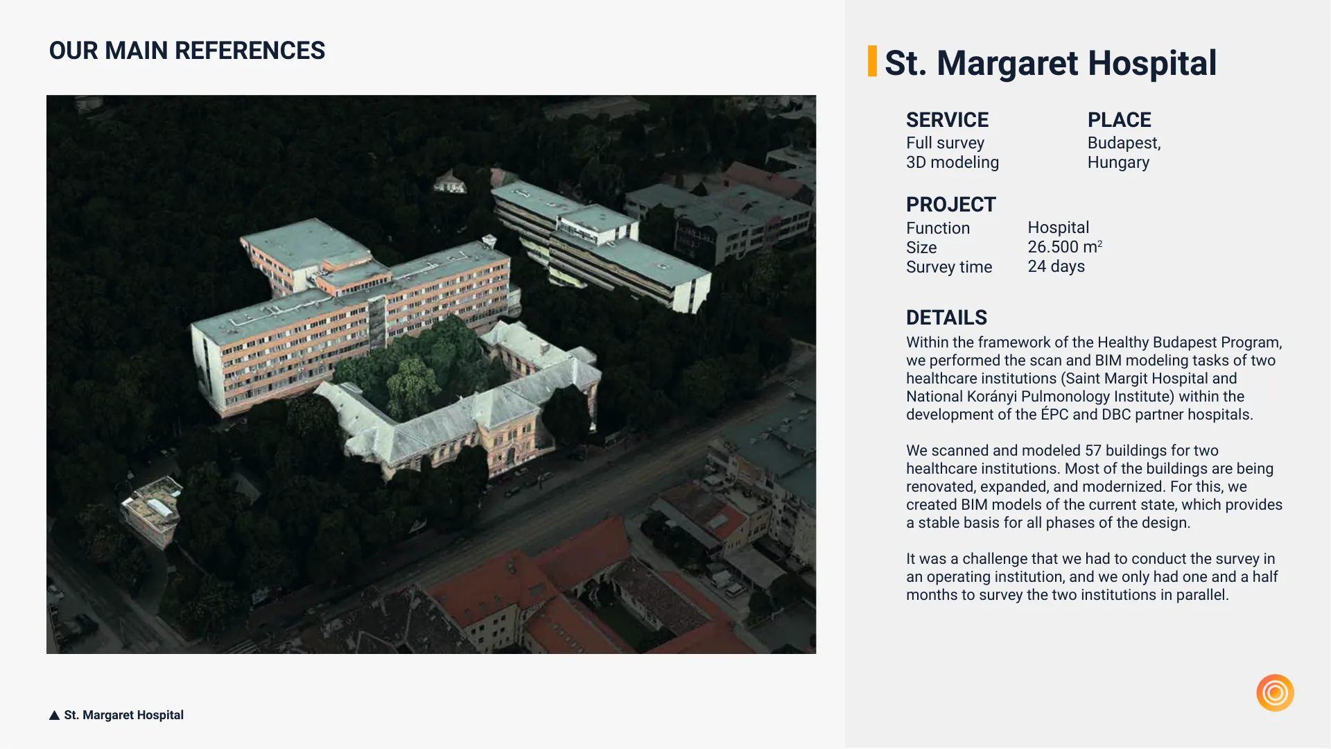
St. Margaret Hospital
SERVICE
PLACE
Full survey
3D modeling
Budapest,
Hungary
PROJECT
Hospital
26.500 m
24 days
2
DETAILS
Within the framework of the Healthy Budapest Program,
we performed the scan and BIM modeling tasks of two
healthcare institutions (Saint Margit Hospital and
National Korányi Pulmonology Institute) within the
development of the ÉPC and DBC partner hospitals.
We scanned and modeled 57 buildings for two
healthcare institutions. Most of the buildings are being
renovated, expanded, and modernized. For this, we
created BIM models of the current state, which provides
a stable basis for all phases of the design.
It was a challenge that we had to conduct the survey in
an operating institution, and we only had one and a half
months to survey the two institutions in parallel.
OUR MAIN REFERENCES
St. Margaret Hospital
Function
Size
Survey time
SERVICE
PLACE
Full survey
3D modeling
Budapest,
Hungary
PROJECT
Hospital
26.500 m
24 days
2
DETAILS
Within the framework of the Healthy Budapest Program,
we performed the scan and BIM modeling tasks of two
healthcare institutions (Saint Margit Hospital and
National Korányi Pulmonology Institute) within the
development of the ÉPC and DBC partner hospitals.
We scanned and modeled 57 buildings for two
healthcare institutions. Most of the buildings are being
renovated, expanded, and modernized. For this, we
created BIM models of the current state, which provides
a stable basis for all phases of the design.
It was a challenge that we had to conduct the survey in
an operating institution, and we only had one and a half
months to survey the two institutions in parallel.
OUR MAIN REFERENCES
St. Margaret Hospital
Function
Size
Survey time
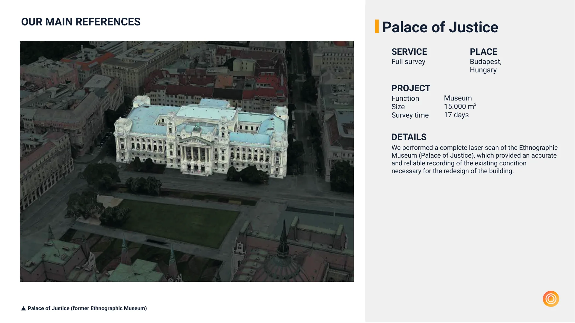
Palace of Justice
SERVICE
PLACE
Full survey
Budapest,
Hungary
PROJECT
Museum
15.000 m
17 days
2
DETAILS
We performed a complete laser scan of the Ethnographic
Museum (Palace of Justice), which provided an accurate
and reliable recording of the existing condition
necessary for the redesign of the building.
OUR MAIN REFERENCES
Palace of Justice (former Ethnographic Museum)
Function
Size
Survey time
SERVICE
PLACE
Full survey
Budapest,
Hungary
PROJECT
Museum
15.000 m
17 days
2
DETAILS
We performed a complete laser scan of the Ethnographic
Museum (Palace of Justice), which provided an accurate
and reliable recording of the existing condition
necessary for the redesign of the building.
OUR MAIN REFERENCES
Palace of Justice (former Ethnographic Museum)
Function
Size
Survey time
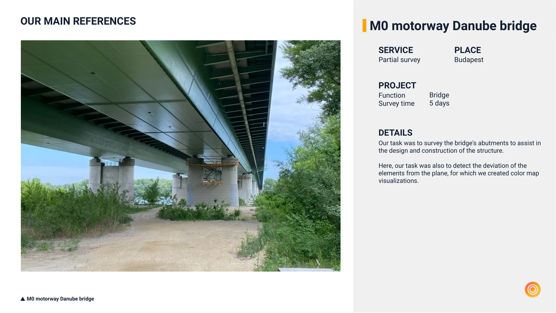
M0 motorway Danube bridge
M0 motorway Danube bridge
Partial survey
Budapest
Bridge
5 days
Our task was to survey the bridge's abutments to assist in
the design and construction of the structure.
Here, our task was also to detect the deviation of the
elements from the plane, for which we created color map
visualizations.
OUR MAIN REFERENCES
SERVICE
PLACE
PROJECT
DETAILS
Function
Survey time
M0 motorway Danube bridge
Partial survey
Budapest
Bridge
5 days
Our task was to survey the bridge's abutments to assist in
the design and construction of the structure.
Here, our task was also to detect the deviation of the
elements from the plane, for which we created color map
visualizations.
OUR MAIN REFERENCES
SERVICE
PLACE
PROJECT
DETAILS
Function
Survey time
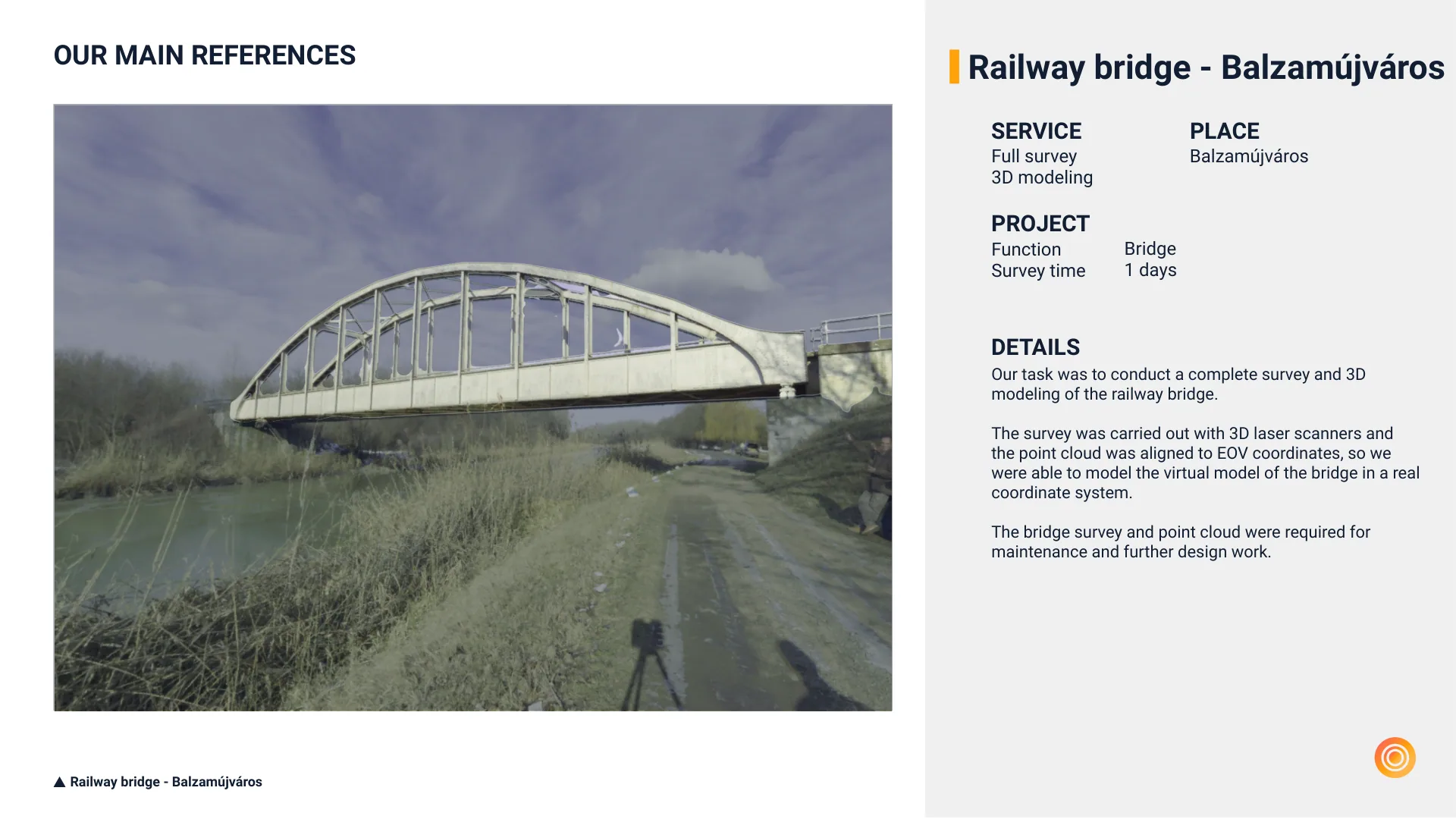
Railway bridge - Balzamújváros
Railway bridge - Balzamújváros
Full survey
3D modeling
Balzamújváros
Bridge
1 days
Our task was to conduct a complete survey and 3D
modeling of the railway bridge.
The survey was carried out with 3D laser scanners and
the point cloud was aligned to EOV coordinates, so we
were able to model the virtual model of the bridge in a real
coordinate system.
The bridge survey and point cloud were required for
maintenance and further design work.
OUR MAIN REFERENCES
SERVICE
PLACE
PROJECT
DETAILS
Function
Survey time
Railway bridge - Balzamújváros
Full survey
3D modeling
Balzamújváros
Bridge
1 days
Our task was to conduct a complete survey and 3D
modeling of the railway bridge.
The survey was carried out with 3D laser scanners and
the point cloud was aligned to EOV coordinates, so we
were able to model the virtual model of the bridge in a real
coordinate system.
The bridge survey and point cloud were required for
maintenance and further design work.
OUR MAIN REFERENCES
SERVICE
PLACE
PROJECT
DETAILS
Function
Survey time
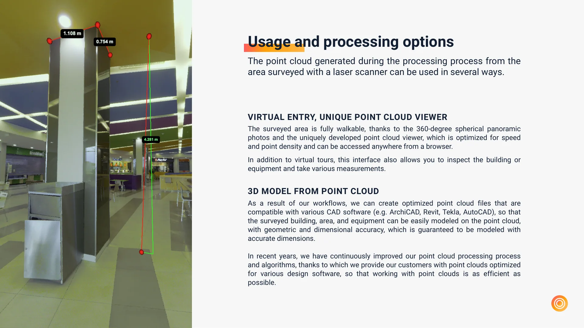
Usage and processing options
The point cloud generated during the processing process from the
area surveyed with a laser scanner can be used in several ways.
The surveyed area is fully walkable, thanks to the 360-degree spherical panoramic
photos and the uniquely developed point cloud viewer, which is optimized for speed
and point density and can be accessed anywhere from a browser.
In addition to virtual tours, this interface also allows you to inspect the building or
equipment and take various measurements.
VIRTUAL ENTRY, UNIQUE POINT CLOUD VIEWER
As a result of our workflows, we can create optimized point cloud files that are
compatible with various CAD software (e.g. ArchiCAD, Revit, Tekla, AutoCAD), so that
the surveyed building, area, and equipment can be easily modeled on the point cloud,
with geometric and dimensional accuracy, which is guaranteed to be modeled with
accurate dimensions.
In recent years, we have continuously improved our point cloud processing process
and algorithms, thanks to which we provide our customers with point clouds optimized
for various design software, so that working with point clouds is as efficient as
possible.
3D MODEL FROM POINT CLOUD
The point cloud generated during the processing process from the
area surveyed with a laser scanner can be used in several ways.
The surveyed area is fully walkable, thanks to the 360-degree spherical panoramic
photos and the uniquely developed point cloud viewer, which is optimized for speed
and point density and can be accessed anywhere from a browser.
In addition to virtual tours, this interface also allows you to inspect the building or
equipment and take various measurements.
VIRTUAL ENTRY, UNIQUE POINT CLOUD VIEWER
As a result of our workflows, we can create optimized point cloud files that are
compatible with various CAD software (e.g. ArchiCAD, Revit, Tekla, AutoCAD), so that
the surveyed building, area, and equipment can be easily modeled on the point cloud,
with geometric and dimensional accuracy, which is guaranteed to be modeled with
accurate dimensions.
In recent years, we have continuously improved our point cloud processing process
and algorithms, thanks to which we provide our customers with point clouds optimized
for various design software, so that working with point clouds is as efficient as
possible.
3D MODEL FROM POINT CLOUD
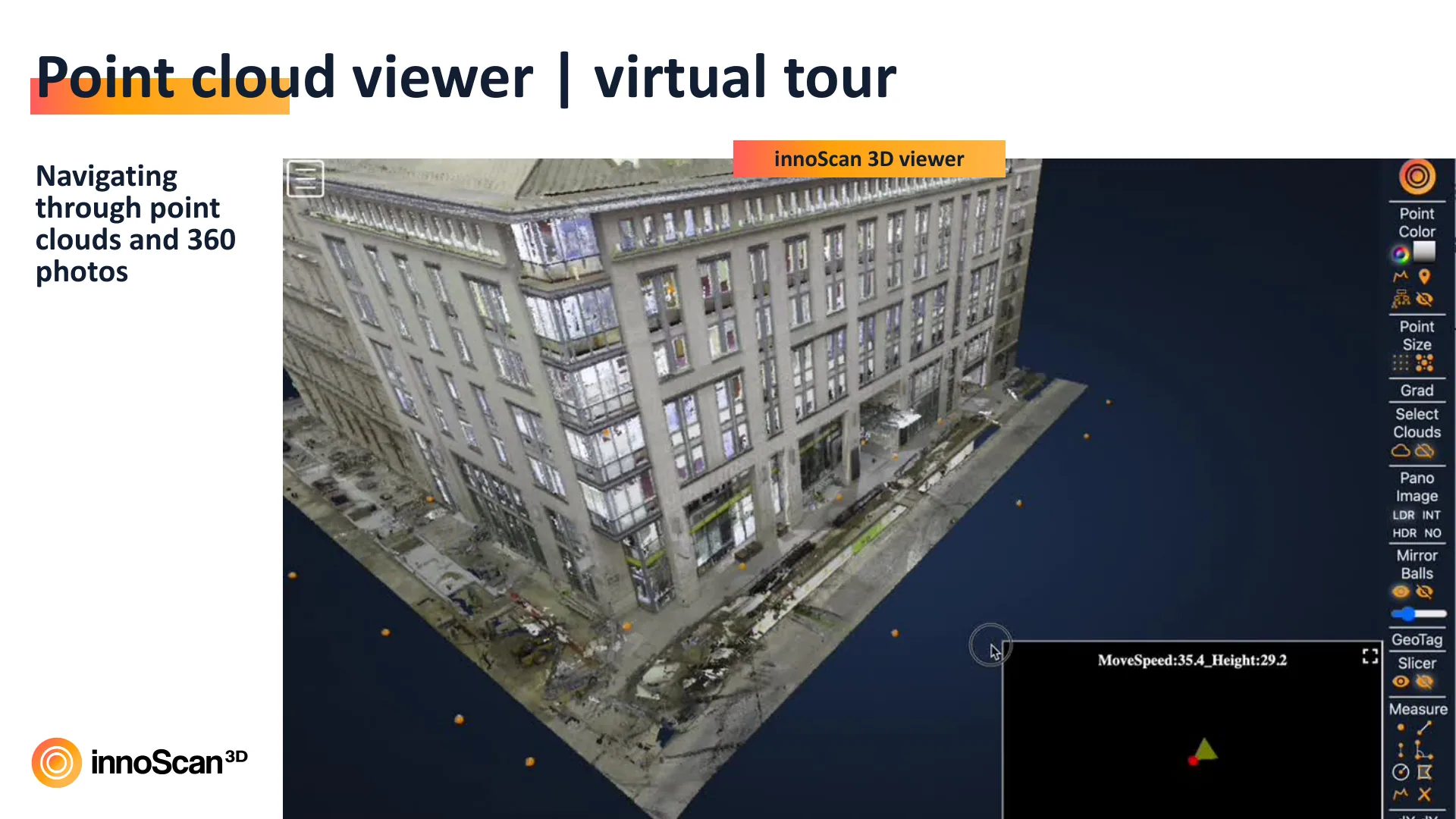
innoScan 3D viewer
Point cloud viewer | virtual tour
Navigating
through point
clouds and 360
photos
Point cloud viewer | virtual tour
Navigating
through point
clouds and 360
photos
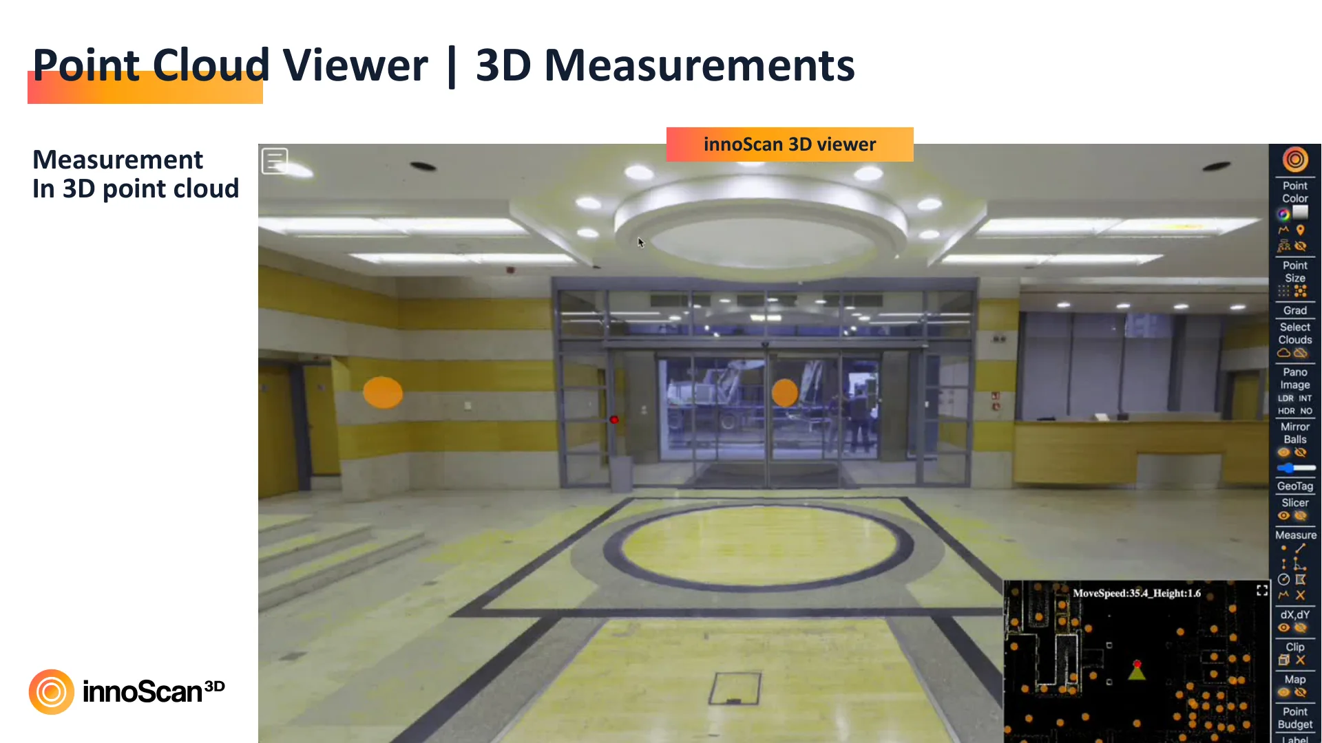
innoScan 3D viewer
Point Cloud Viewer | 3D Measurements
Measurement
In 3D point cloud
Point Cloud Viewer | 3D Measurements
Measurement
In 3D point cloud
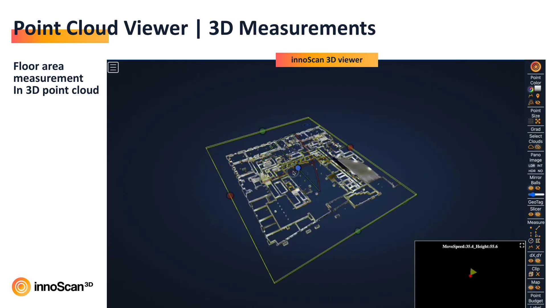
innoScan 3D viewer
Point Cloud Viewer | 3D Measurements
Floor area
measurement
In 3D point cloud
Point Cloud Viewer | 3D Measurements
Floor area
measurement
In 3D point cloud
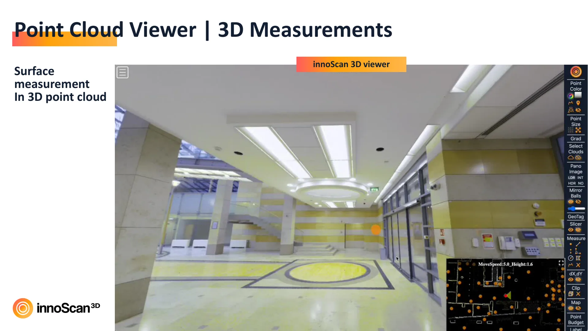
innoScan 3D viewer
Point Cloud Viewer | 3D Measurements
Surface
measurement
In 3D point cloud
Point Cloud Viewer | 3D Measurements
Surface
measurement
In 3D point cloud
innoScan 3D viewer
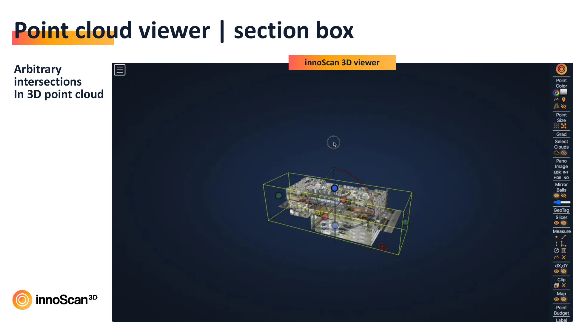
Point cloud viewer | section box
Arbitrary
intersections
In 3D point cloud
Point cloud viewer | section box
Arbitrary
intersections
In 3D point cloud
innoScan 3D viewer
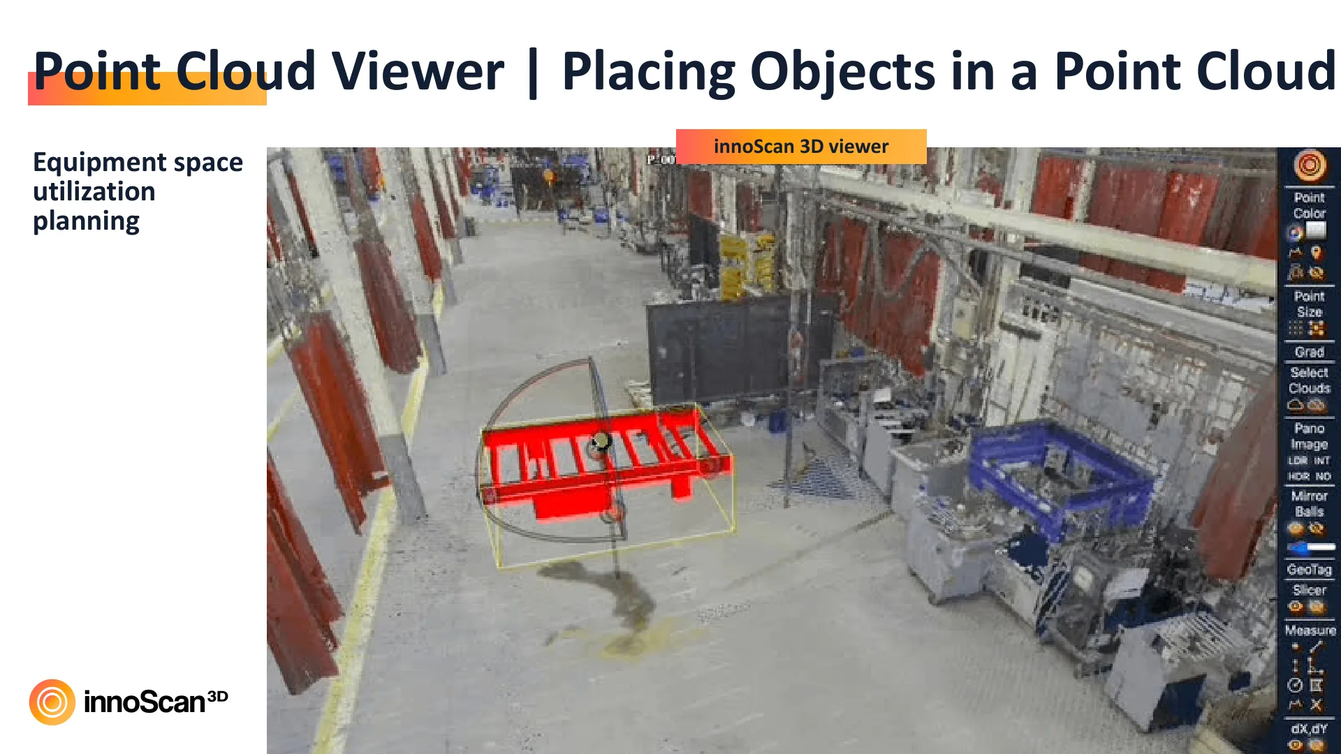
Point Cloud Viewer | Placing Objects in a Point Cloud
Equipment space
utilization
planning
Point Cloud Viewer | Placing Objects in a Point Cloud
Equipment space
utilization
planning
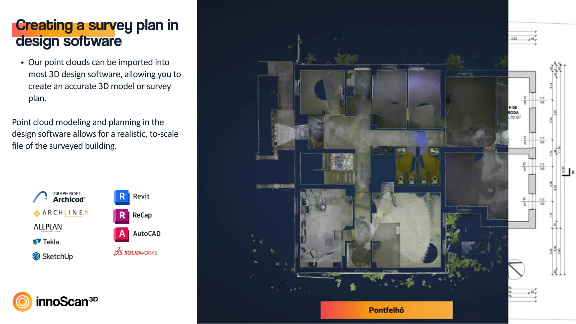
Creating a survey plan in
design software
Our point clouds can be imported into
most 3D design software, allowing you to
create an accurate 3D model or survey
plan.
Point cloud modeling and planning in the
design software allows for a realistic, to-scale
file of the surveyed building.
design software
Our point clouds can be imported into
most 3D design software, allowing you to
create an accurate 3D model or survey
plan.
Point cloud modeling and planning in the
design software allows for a realistic, to-scale
file of the surveyed building.

Contact
Daniel Vida
Managing Director
link.innoscan3d.com/VD
Contact backup
www.innoscan3D.com
[email protected]
+36 70 398 4619
Hungary, 1094 Budapest, Üllői út 55.
innoScan 3D Ltd.
Tax number: HU24675891
Daniel Vida
Managing Director
link.innoscan3d.com/VD
Contact backup
www.innoscan3D.com
[email protected]
+36 70 398 4619
Hungary, 1094 Budapest, Üllői út 55.
innoScan 3D Ltd.
Tax number: HU24675891